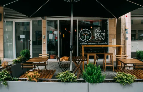

HopTrip Craft Beer
0.5 mi from the city centre
Matosinhos, Portugal
Matosinhos is a working seaside city on the Atlantic just north of Porto, shaped by fishing, canning and the Port of Leixões. Read on for its long beaches, Siza Vieira's tidal pools, a giant net sculpture, Roman salt tanks and metro links to Porto.

Filter by venue type
Pins match the listings on this page. On a touch screen, tap a pin to see its details. Every listing also opens from its card.
Matosinhos sits on the Atlantic coast just north of Porto, where the River Leça meets the sea. It is a working seaside city shaped by fishing, canning and the great Port of Leixões, with long sandy beaches, landmark modern architecture and a strong seafaring identity.
Take Porto Metro Line E, which runs to the airport and serves parts of the municipality. The airport itself lies partly within Matosinhos. Line A links the centre of Matosinhos with central Porto via Senhora da Hora, Lines B and C serve other areas, and UNIR buses cover the wider metropolitan area.
Take Porto Metro Line A, which links central Porto with the centre of Matosinhos via Senhora da Hora. Lines B, C and E serve other parts of the municipality, and buses across the metropolitan area run under the UNIR network. The seafront sculpture marks the border between the two cities at the Cidade Salvador roundabout.
They are a saltwater swimming facility built among the natural rocks of the Leça da Palmeira coast. Designed by architect Álvaro Siza Vieira, who was born in Matosinhos, they are one of his early works from the 1960s and a National Monument. A morning at the pools or on the beach is a classic start.
Spend the morning on the beach or at the tidal pools, the afternoon in Leça da Palmeira and the harbour, and the evening watching the Atlantic sunset. Start at the seafront sculpture, visit the Church of Bom Jesus, then cross the river to see the fort, the lighthouse and the park.
Updated